|
COLORADO FRONT RANGE 1200
| |
| Rocky Mountain Cycling Club SANCTIONED BY Randonneurs USA · Randonneurs Mondiaux | ||
2023 Ride Narrative
|
Stage 1: Lefthand Canyon
— This is the longest stage, with the most climbing, and highest elevation.
But it is balanced by more miles out on the Plains, to make for a good start on the total mileage of the event.
Platteville — This first flattish segment is a chance to warm up and build some distance. Platteville, a.k.a. "The Rando Vortex" because a number of perms and brevets mysteriously transit this town, boasts giant homemade burritos at the Exxon. Too giant? Split one with a riding pal! Lefthand Canyon — The first 15 miles of the climb are at a moderate grade. The grade the final couple of miles, through Ward, is quite stiff. Water at milepost 16 and a store on the right in town. Event high point is 9,260 ft. at the junction of the Peak-to-Peak Highway. Peak-to-Peak — The 8-mile segment on the Peak-to-Peak Highway (Hwy. 72 at that point) is rolling, with some big descents. Before the descent to Peaceful Valley at mile 96, view of Indian Peaks (Continental Divide), including Mt. Toll, Arapahoe Peak, and others. St. Vrain Canyon and Raymond — We veer from the Peak-to-Peak Highway onto Riverside Drive, a narrow, winding road past the Raymond Store - watch for sand and pedestrians. St. Vrain Canyon is a pleasant, exhilarating descent with mainly moderate grades, though tighter curves lower down (near milepost 28). Horsetooth Reservoir and Ft. Collins
— There are three climbs on the Horsetooth segment. Recreational traffic, but a good shoulder along the reservoir.
On Taft Hill Rd. crossing Horsetooth Road, look left (west) and you can see the Horsetooth "tooth" formation.
Ft. Collins is a built-up area,
but almost all of this segment has a good bike lane. Leaving Ft. Collins on State Highway 1, you pass Terry Lake,
and then you're out on the Plains.
Wellington - Windsor - Milliken and back to Louisville
— The final miles are out on the wide plains. Hwy. 257 can be busy, but has a large shoulder.
Watch for debris on shoulder, however (sand, gravel,
and in some places asphalt fragments). Coming into Windsor, you may see cormorants and white pelicans
on Windsor Lake (left/east side). You then pass through the water-themed area along Eastman Drive (named for the
large former Kodak facility east of town). After climbing up and over Rd. 19, the route is similar to the initial miles of this stage,
and on into Louisville. There are limited services open after 9pm, so make plans and stock up in Windsor or Milliken accordingly.
Ft. Lupton Warm-Up
— We start again with a warm-up on the Plains. As you pass through Hygiene,
this is the last point with services (the Mountain Fountain) until Glen Haven.
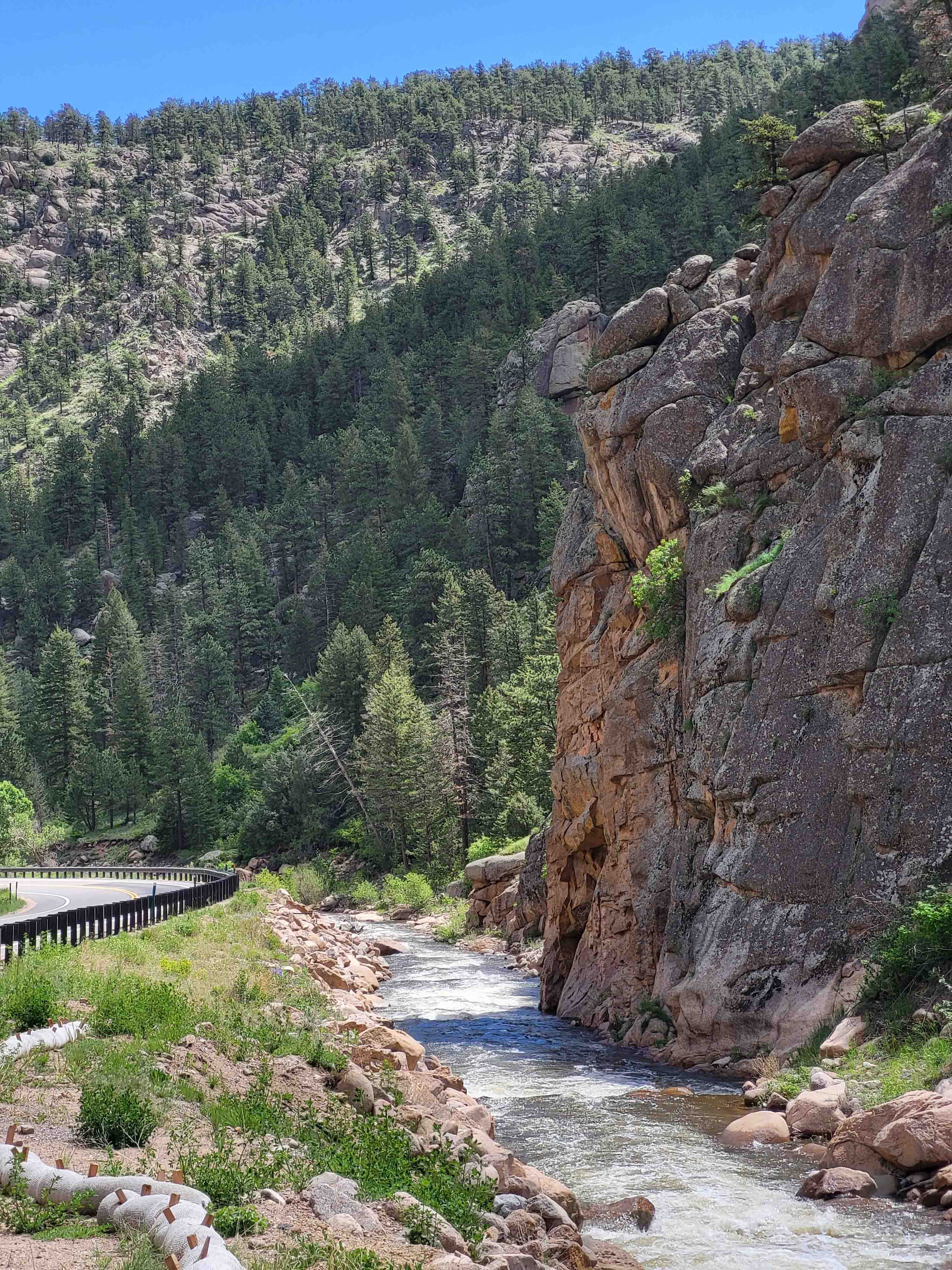
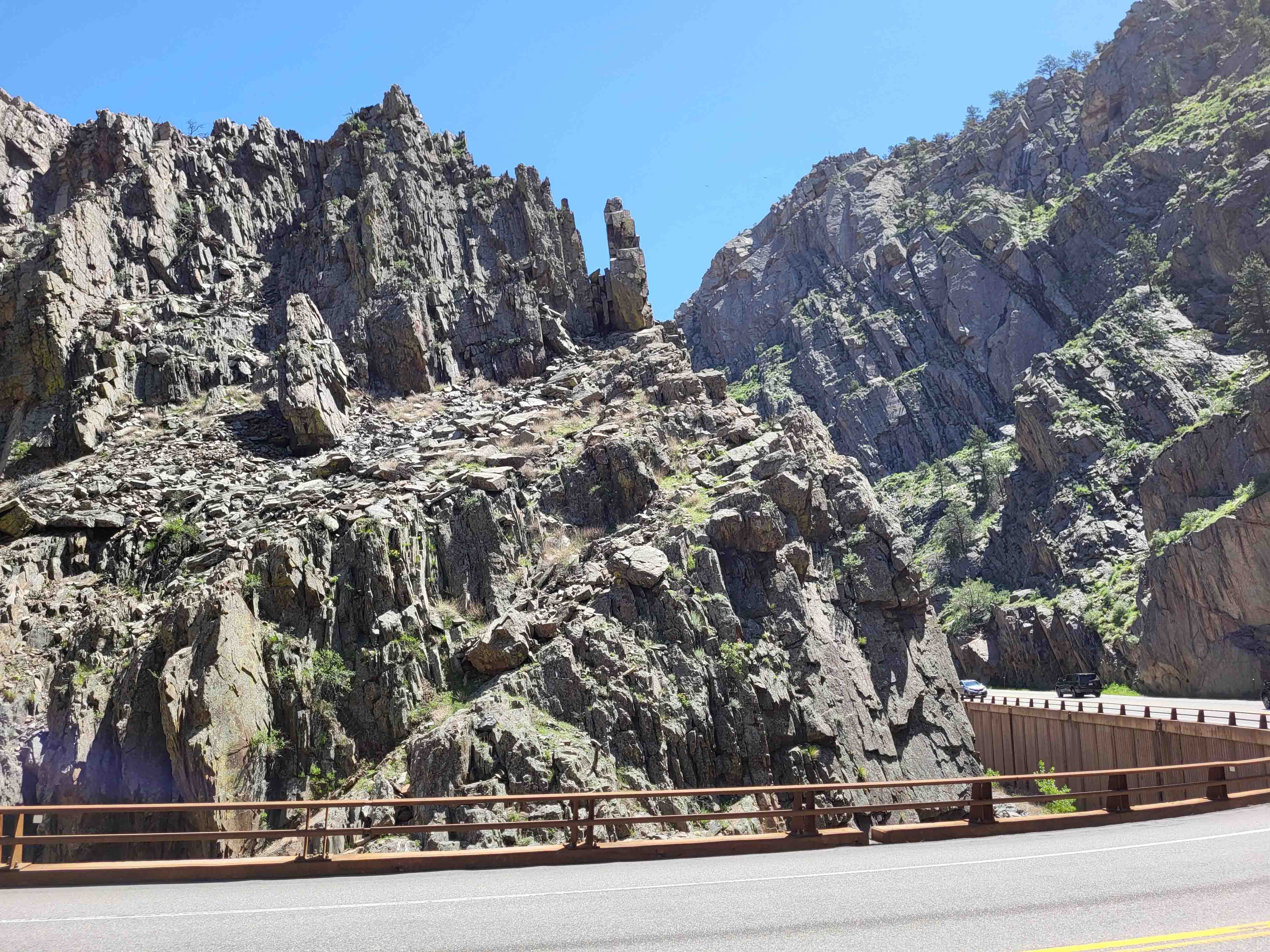
Big Thompson Canyon - North Fork Big Thompson - Glen Haven
— US-34 along Big Thompson Canyon has traffic, but a good shoulder.
At the mouth of the canyon, you pass through the Narrows, the most dramatic section of the canyon, with high rockfaces.
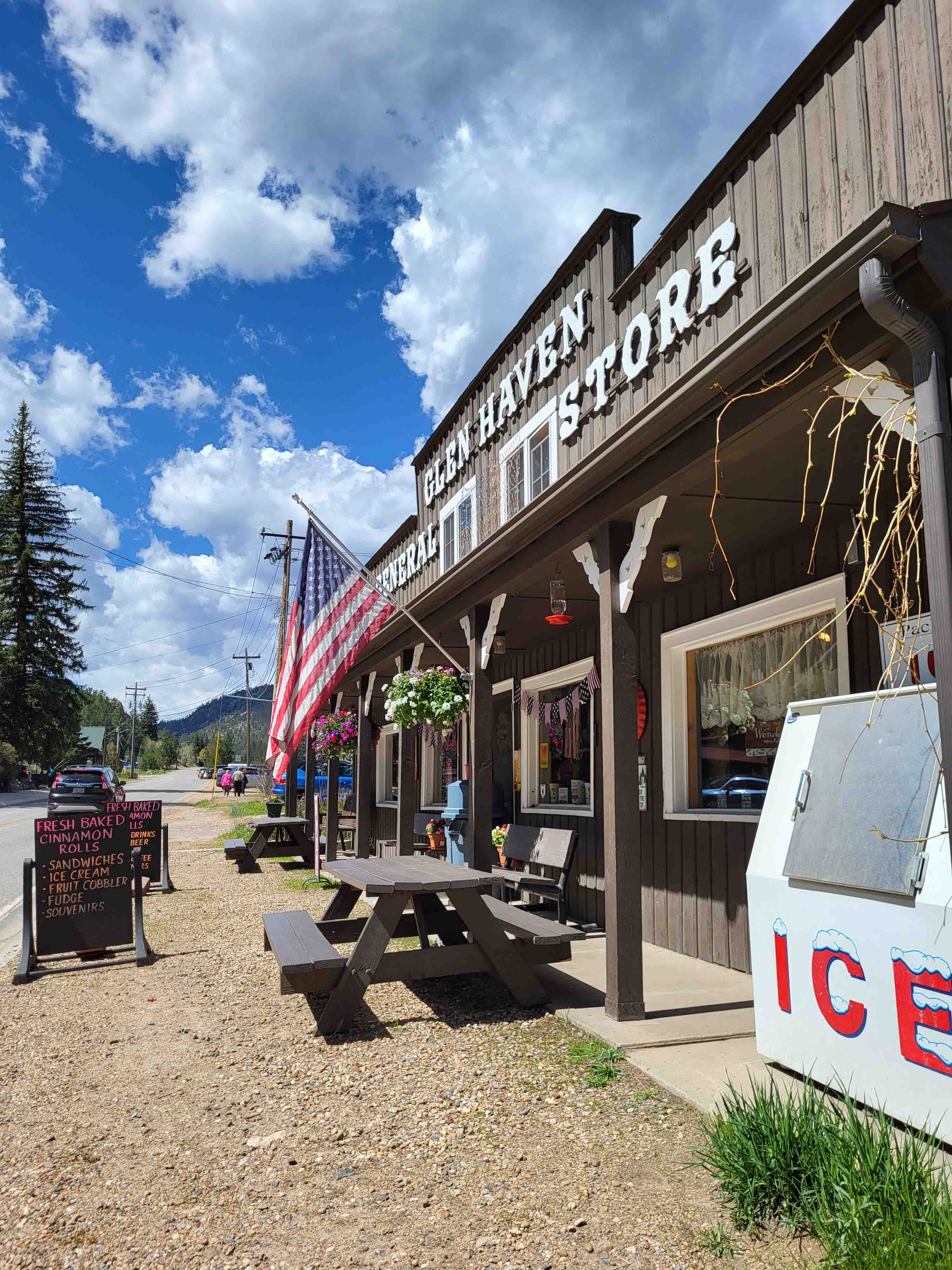
Mild to moderate grades. The Glen Haven Road, along the North Fork of the Big Thompson, is usually very quiet, again with mild
to moderate grades. The Glen Haven General Store has drinks, snacks,
homemade sandwiches to order, and cinnamon rolls.
After descending, you take a side road featuring ⅓-mile of unpaved surface, and a drop off to the river below.
A very quiet stretch but watch for horses and motorists around blind curves.
After Masonville, you can stop at Sandy's for food and drink.
Apple Valley and Return
— We round out the stage with one of our favorite roads, Apple Valley Road,
featured in our Apple Cider Sally 100k Perm Populaire. (You'll be transiting Lyons to get there.)
The stage finishes with a straightforward return to Louisville.
Stage 3: Poudre Canyon
— High Country 1200 riders will be familiar with Poudre Canyon,
although on this 1200k we are only climbing halfway up.
Sandy's - Horsetooth - Overland Trail
— We head straight up from Louisville over Horsetooth Reservoir, much as the High Country 1200 does.
(This is also the route for our Poudre Canyon "Early Bird" brevets in May.)
Sandy's should be open as you reach that store, so consider a stop for refreshment.
You traverse the same stretch over Horsetooth but early in the morning, on a weekday, so it should be pretty quiet.
Check out the 7-Eleven on Overland Trail or Ted's Place at the base of the Poudre Canyon climb,
as there are no services until Rustic, except for the Mishiwaka restaurant at mile 14 up the canyon.
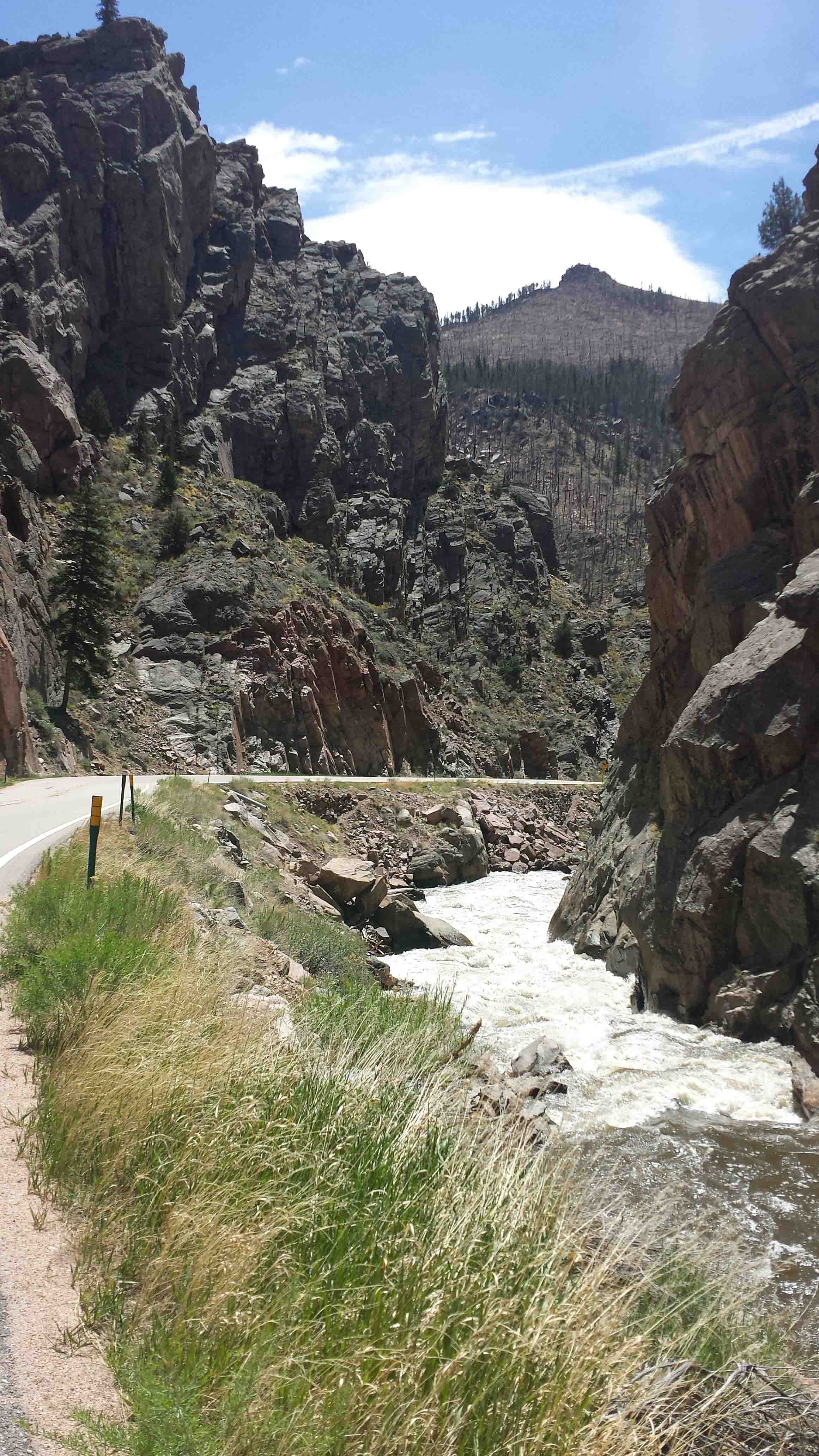
Poudre Canyon
— The climb is mild to moderate, about 2,000 ft. gain over 31 miles. The biggest factor in effort could be
the wind direction. Hwy. 14 in the canyon has little to no shoulder. But the speed limit is low and motorists tend to be alert and polite.
This canyon carries recreation traffic including trailers, and rafting buses. Should be quieter during the week, when we are riding.
Also: here and there, rumble strips have been added beyond the edge of the road proper.
There is no real space to ride to the right of the rumble strips, so stay to the left.
The Glen Echo Store at the turnaround is your chance to resupply.
Taft Hill Road - Loveland - Louisville
— After descending to LaPorte and Ft. Collins, you'll be leaving town on Taft Hill Road which
has a shoulder, but does have traffic volume. After Loveland, we're back on the normal county roads heading back
through Hygiene to Louisville.
Stage 4: Jamestown - Carter Lake
—
James Canyon
— After the first 5 miles of the Lefthand Canyon climb, we branch off to the narrower James Canyon.
At Jamestown, there is a water dispenser on the south side of the street and on the north side, the Jamestown Mercantile,
where you can sit down for a homemade burrito or other treat.
Carter Lake
— The climb Carter Lake is only about 300 ft. with a couple of switchbacks,
and onto the scenic lakeside drive. You can stop at the Carter Lake Marina Store for a snack.
Return to Masonville and Storm Mountain Road
— Your final visit to Masonville takes you up Buckhorn Road past some
scenic ranches and rockfaces to the turnaround at Storm Mountain Road.
Cherryvale Rd and Marshall Rd
— We end our 1200k with a different way to the finish, past
scenic Baseline Lake, onto Cherryvale Road, and up and over Marshall Road. On the way, you may notice
a lot of new construction on country parcels. These were victims of the Marshall Fire on December 30, 2022
that flew from Marshall across the prairie into Louisville, destroying 1000 homes.
You finish on the Denver-Boulder Turnpike bike path, whooshing down to the finish line!
The Flood of 2013 - A Sidebar
— In September, 2013, the Front Range from Golden to Estes Park was inundated with heavy, slow-moving showers
that caused flooding down a number of canyons and out to the Eastern Plains. (Last Chance 1200k riders were at that moment
heading back from Kansas, but the timing allowed them to dodge most flooding.) See the Wikipedia article,
2013 Colorado floods.
Except for Poudre Canyon, all the canyons on the 2023 Colorado Front Range route - Lefthand Canyon, James Canyon, St. Vrain Canyon,
Big Thompson Canyon, and North Fork Big Thompson Canyon - were affected. (Poudre Canyon was instead affected by the big wildfires
of 2012, during the High Country 1200.)
When Lefthand Canyon initially reopened to traffic, it sported a dozen dirt stretches. For a couple of seasons, riders in search of
gravel riding could simply ride Lefthand Canyon Drive. Flood-affected roads were closed in succession to all traffic for a year or more, as construction projects proceeded.
Our brevet routes changed and changed again, depending on which roads were open.
Over the course of the next nine years, these canyons were repaired, enhanced with culvert and other work, re-engineered in places,
and repaved. Big Thompson Canyon includes a new rock cut bringing the road above the river and making a shallower curve.
The Glen Haven road along the North Fork Big Thompson rivers is now a bit wider and the curves
are less severe. The Glen Haven Store is one of only three structures
left standing after the flood - and it needed to be propped up. (The others were the Inn across the street and the post office.)
The final project was St. Vrain Canyon, which was closed to cyclists for a year from 2021 to late 2022.
As a side effect of all of this, though, is that
the roads in these canyons are in good shape and a pleasure to ride. We hope you will enjoy all these miles.
- - -
| 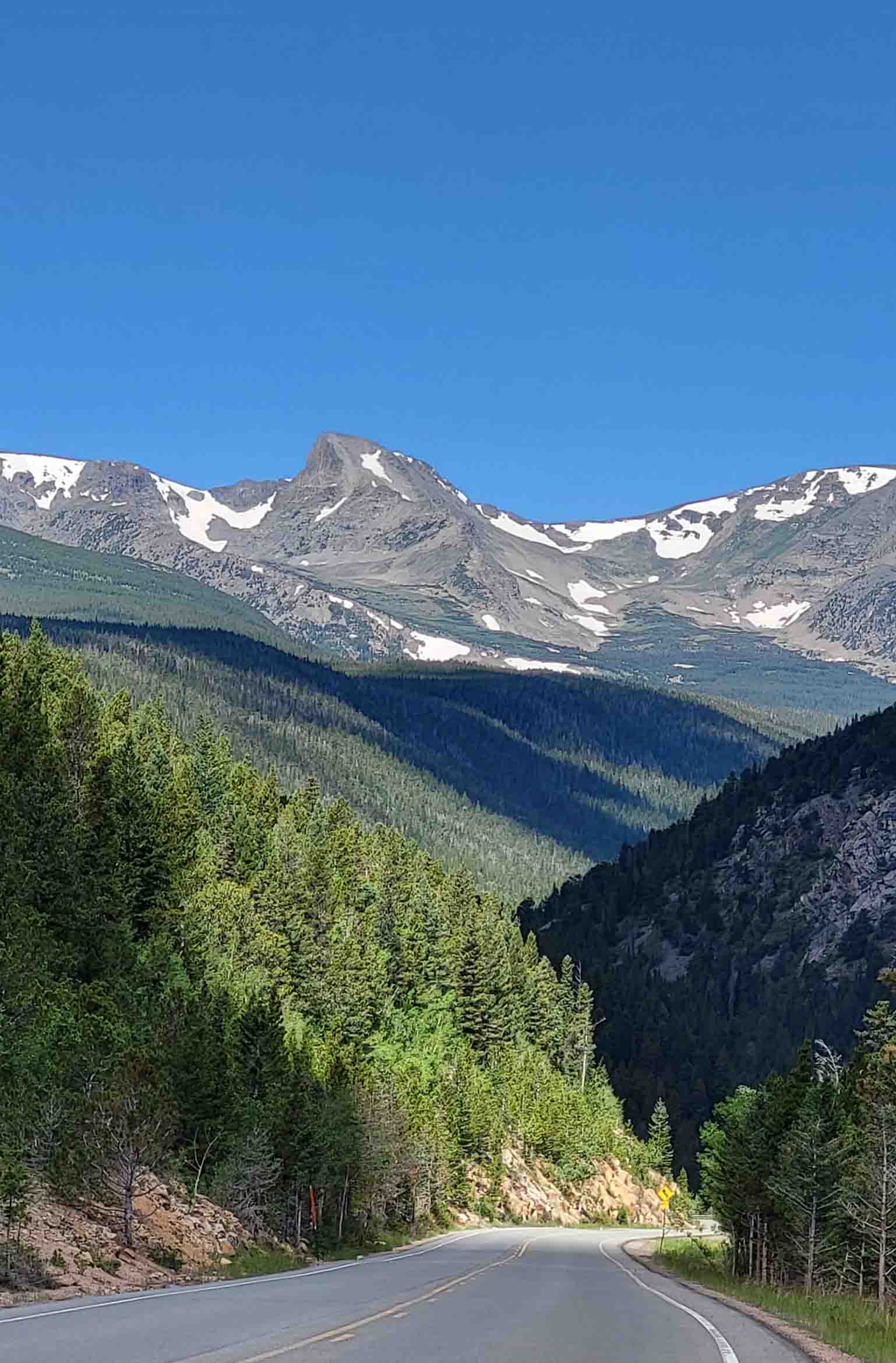
Indian Peaks
|